ProximityCast.com

Monday, March 29, 2010

A ProximityCast Restaurant Rendezvous

Pleasure disappoints, possibility never. And what wine is so sparkling, what so fragrant, what so intoxicating - as possibility?
by: Soren Kierkegaard (1813-55)
Danish philosopher

Cafe Pontalba

So you find that special restaurant that you would like to take that special person out to eat at... You want to build the anticipation for the special moment and give that special person a sense of the ambiance you two will enjoy at the chosen place...

Now you search ProximityCast.com and find some kind user has already submitted a nice picture of the current favored restaurant. So you go to the Establishment Details page to get some goodies to email your special someone...

Click Pic to see a Larger Image


Cafe Pontalba

In the Top Right Hand Corner you click the "Authorized for Social Sharing" button so you can easily copy a link to the picture to email to that special someone...
http://www.proximitycast.com/aGem/contributor/dave/photos/pce1807.jpg

Next you click the "Establishment Website" link just under the "Authorized for Social Sharing" button to find a menu...
http://www.neworleansrestaurants.com/cafepontalba/menu.html
Cafe Pontalba Menu
Cool! The Establishment Website has a menu...
No surprises! You have an idea of what to order and what it will cost so both you and that special someone can experience Deja Vu upon Arrival all thanks to ProximityCast.com

And you thought Google's Street View was cool... Well, it is... Enter the coordinates from the ProximityCast picture N29°57.44' W090°3.82' into Google Maps and compare the two...

Yep, this is the one! Enter the coordinates into your GPS so you know you will arrive at the correct spot and not some bogus street address mislocated spot...

Your special someone responds back after sending the email with all the appropriate data for making a good decision...

The rendezvous is set...

SHUCKS...
The restaurant of your dreams cannot be found in ProximityCast...
What to do, what to do?
Wow! Anyone can register and enter a location picture into ProximityCast.com/register

The best part, geographic coordinates work the same way anywhere in the world...
Street addresses vary from country to country and are often wrongly located on Google Maps and others...
What kind of useful, exotic, or interesting restaurants can you submit?

Founder out...ciao

Saturday, March 27, 2010

Ideas are useless unless used

Ideas are useless unless used.
by: Theodore Levitt (b. 1925)
U.S. management theorist, writer, and editor.

ProximityCast.com was born as only an idea. A remarkable set of events caused it to be birthed into a reality. It is still only an infant, but it has seen the light of day.

I personally use ProximityCast. I also use and enjoy Google Maps and Street View. ProximityCast can get you there quick if you know how to Navigate the Site. I'll get to that toward the end of this post, but now I'll share a small story.

I love GPS and the navigational possibilities it provides. As a helicopter pilot I cut my teeth on navigating before GPS became a reality. A fact of life back then was that it didn't matter how smooth and talented a pilot was at manipulating the controls, if he couldn't navigate he was worthless. Successfully getting to where you need to go is more important than a smooth ride. A pilot who could do both was "Top Shelf".

GPS changed all of that. Now it doesn't matter if a pilot has no navigational skills. As long as he can plug in the correct numbers into his/her GPS he/she is good to go! Any dummy can do it. GPS was the solution to prevent DMZ overflights into North Korea. GPS drives EMS. I loved navigating without GPS. Dropping into an LZ (landing zone) for the first time just by reading a topo map from tree top height is quite a thrill! But now all that is obsolete thanks to GPS. I still love GPS and what it allows us to do. Simply Awesome!

Have you ever had a street address fail you on Google Maps? I have. GPS coordinates are ten times better especially when they are certified correct. ProximityCast gives you that. Submitters will receive an accuracy rating as soon as we get a plethora of users making a photographic contribution. With a submitter accuracy rating you can know who to trust and who to be skeptical of.

Expect "deja vu upon arrival" and NOT the disappointment upon arrival a street address sometimes gives you.

Okay, here's the easy way to get from ProximityCast to Google StreetView of your Establishment of Choice!

Like "Norm's Diner" in Groton, CT:


Norm's Diner Groton CT

Click the MAP VIEW button at the top of the 6 pack of Cast Results:
Norm's Diner

Once in the MAP VIEW click on the Establishment Picture you wish to view in Street View and then click "Directions" on the PopUp to go into the actual Google Maps Site:
Norm's Diner Groton CT
From there if you are familiar with Street View you can see if the area is covered and click on the "B" marker then "Street View" to see how the two compare.
Norm's Diner looks pretty good. What do you think?

I didn't create ProximityCast just for me, but for all of us. Check it out, try it out, and let me know what you think. I am interested in making it a site you like to use!

Thanks,

Founder out...ciao

Wednesday, March 24, 2010

Considering Something Ideal

When you consider something "ideal", you lose the opportunity to improve it.
by: Shoji Shiba (b. 1933)
Japanese academic and author.

ProximityCast is not "ideal" yet. If you know of a location based service that is, please leave a comment of how I can look at it and why you think it is ideal.


ProximityCast does meet its basic goals even at this stage:

  • Location based service where users can add content and correct content for everyone's benefit.
    • Try doing that with the Points of Interest in your GPS


  • Provide a quality picture so you know what your destination looks like before you get there.

  • Provide location's Latitude and Longitude on the picture.
    • Once again, this acts as the Photographer's certification that if you arrive at the coordinate location you will see what is in the picture. Try doing that with a Street Address in a Location Based Service; sometimes they get you there, sometimes they don't.


ProximityCast is following the Wikipedia model now as in relying on user's input. Anyone have any tips for me as to how to get more users to input pictures?

Monday, March 22, 2010

On the Menu: The "Tour" item

The "tour" item is the first menu item on the bottom horizontal menu on the Main Page!

This is some of what you'll see there:

How to do a ProximityCast Search!


  1. Enter Cast Initiation Point


    • Enter a location to search from.

      • Your home town.

      • A Street Address

      • A Latitude and Longitude


    • Click help for details.


  2. Select Desired Category

    • The top box uses autosuggest to help you find what you want fast.

    • The bottom drop down box lets you browse all available categories when you are unsure of what you want.


  3. Click "Perform ProximityCast"


    • This will take you to your CastNet Results


Understanding the Search Results Page!


  1. Always shows what you entered into the Cast Initiation Point box.

  2. Clicking the ProximityCast.com logo image always returns you to the search page.

  3. Shows the Latitude and Longitude of your Cast Initiation Point.

  4. Shows the "straight line" distance from the Cast Initiation Point to the Establishment that has the focus.

  5. The Cynosure Image!

    • Initially this is the closest establishment to your Cast Initiation Point.


    • Clicking this picture will take you to the Details Page for the shown establishment.


  6. Shows the database coordinates in all three formats for easy comparison with the coordinates shown on the cynosure image.

    • This is IMPORTANT because it lets you discover errors before traveling to a chosen destination.
      • Coordinates on the image serve as the photographer's certification that the location is correct.

      • A discrepancy usually indicates an error was made during coordinate entry into the database.


  7. Allows you to perform another search using the the cynosure image as the Cast Initiation Point.

  8. Allows registered users to flag data that has changed or is in error.

  9. Thumbnail of all establishments returned in the ProximityCast. Clicking any thumbnail makes it the cynosure image.

  10. Takes you to a Google Map mashup where you can visually see where all establishments are in reference to the Cast Initiation Point.

    • Get Driving Directions from the Cast Initiation Point to any selected establishment.


Now you can Quickly Master ProximityCast.com!

Saturday, March 20, 2010

ProximityCast on the iPhone

The Safari Lite Browser on the iPhone and the iTouch is pretty nice. This is a picture of ProximityCast's home screen.

I find I prefer sites on the Safari Lite Browser that have not been optimized for mobile devices due to the ability to zoom in and out which is lost with mobile device optimization.

Making a ProximityCast is as EASY as 1. 2. 3....


  1. Enter your Cast Initiation Point ~ the place from where you wish to search.
    • ProximityCast takes Lat/Long or Street Addresses

  2. Enter your desired search category
    • Simply start typing what you want. e.g. cof...ProximityCast will complete your selection cofFEE

    • or use the Category Selector to browse all available Categories

  3. Click or touch: Perform Proximity Cast


Then view your results!


ProximityCast is loaded with features which require a little time for familiarization, but once that is done... It is super easy to use.

Compare a ProximityCast Establishment Picture with a picture from Google's StreetView. I really like street view, but the pictures are not always the greatest.

ProximityCast is in BETA and can use input so we can plan the best improvements to meet your needs.

Till next time,

Founder out!...ciao

Friday, March 19, 2010

Aiming for the "B" Quadrant ~ Rich Dad/Poor Dad

In Robert Kiyosaki's book he describes the four quadrants income can come from. E/S/B/I...
Rich Dad Poor Dad
ProximityCast is currently in the "H" quadrant. The "H" quadrant doesn't produce any income and it is called a Hobby. Even though it is only a Hobby at this point in time being developed on a bootstrapper's budget, I have my sights on the "B" quadrant.
I have been in the "E" quadrant all of my working life. This is the employee where you derive your wage by working for someone else. It is hard to really get ahead as an employee. Not impossible, just difficult. Then there is the "S" quadrant which is for the self employed. The self employed is mostly just a glorified employee. The biggest benefit for the self employed is that they don't have a boss they have to answer to because they are the boss. The biggest drawback to the "S" quadrant besides having to work twice as hard and wear multiple hats than the typical employee is that once your time on this earth is all said and done, so is the business you worked so hard to create. Basically you are the business. When you cease to exist, so does the business. Currently ProximityCast would be in this quadrant if it was making any money.
Then there is the "I" quadrant. I could use some people that are players in the "I" quadrant to help move ProximityCast into the "B" quadrant. I've had an interest in the "I" quadrant which is all about investing. To get into the game you have to have marbles in your bag.
Now the "B" quadrant is the business quadrant. Many in the "S" quadrant may feel they are players in the "B" quadrant, but there is a BIG difference. The "S" quadrant always requires the main player's presence where the "B" quadrant does not once the system is set up. I know ProximityCast has all the raw ingredients to become a system that can exist long after I'm gone. Whether or not I will be successful getting it there is another story. But, I press on.

Here are my weak links that impede progress as I see it.


  1. I am a solo founder.

  2. For my family's sake I choose to live in the Ozarks.

  3. I'm working on a bootstrap budget.


#1 just fell out like that. My buddy in school whom I invited couldn't grasp the vision. I'd rather fly alone than have someone on-board that is not a true believer. I'm not opposed to having another one or others come on-board if they can be true believers and bring something to the table worthwhile. That something does not have to be technical skills. Those can be hired. Business savvy, a vision, able to be a team player with a focus on developing the system that can enter and be a real player in the "B" quadrant, are things I'd consider as valuable and would welcome to the team, if they are out there.

#2 kinda just worked out like that too. It's where I found myself when the idea began to come together. From what I've learned there are better places to be in the USA if you want to establish a "B" quadrant entity. I'm not opposed to moving, but the cards have to be ready to be played. I'd even consider Singapore or Hong Kong if that proved to be the true home for ProximityCast which is viable world wide.

#3 There are several ways I can see where that could change. I looked over a "Loan Package Development for New Business" for the U.S. Small Business Administration recently. I don't believe that is going to happen. I'm a free man right now where working on ProximityCast is a labor of love. I'm free to do it or not do it. I'd shift gears, but only with a deal that will squarely put ProximityCast into the "B" quadrant as quick as possible where it could continue on with or without me. I may be wrong, but I don't think a SBA loan would do that. So, I'll be content to creep along until something else takes ProximityCast into the "B" quadrant. Or not...

Tuesday, March 16, 2010

ProximityCast and Flying Helicopters

I have a passion for ProximityCast and I have a vision.

I don't know how far down the rabbit hole I will be able to take the vision, but I plan on having fun along the way.

Somethings are meant to be. The pieces just seem to fall in place and things seem to happen as they ought.

I became a helicopter pilot much like this. It just seemed to be my destiny.

I wish my journey to entrepreneurial success would be the same. The ProximityCast denouement is not yet written, so I'll try to enjoy my journey whether it remains a hobby or gets wings and takes off.

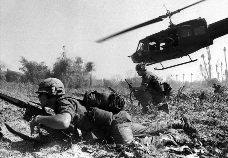
The making of a helicopter pilot...


I guess it is time to get off track just a bit and tell this story.
My dad would have paid for me to go to college upon completion of high school. I could see the writing on the wall though. With my attitude back then it would have been a waste of time and money.

I wish I could have known back then that I had a potential to love math. I made a D in 9th grade algebra. I think I probably deserved an F, but my other grades were okay and the teacher didn't want to be the one that flunked me. When I finally got around to going to college I learned how to make all "A"s in my math classes all the way through Calculus III. But I did it as an older man, so it took a lot of hard work and has not become as natural as flying helicopters (something I learned in my youth).

Anyhow, I have a bit of a pragmatic streak in me and I wanted to do something worthwhile and practicable. I never ever dreamed I'd be a pilot. Flying was for rich people. I grew up in a comfortable home, but we were a long way from being uber rich. But I was a certified SCUBA diver, and I thought the military could teach me to be a commercial diver. So, I set up an appointment to talk to a Navy Recruiter.

I told this man I was interested in commercial diving. He told me that the Navy has more combat divers than commercial divers. And he said if I was really interested in commercial diving I should talk to the Army.

Well that got me talking to an Army recruiter.

Back in those days the Vietnam War was going hot and heavy. Most people I encountered were pretty negative on the war and tried to dissuade me from going into the military.

I met an Army diver. He told me, "I scrubbed more toilet bowls than I got to dive." It didn't sound too promising.

Then I met a man that said, "If you really have to go in then you should go in as an officer. Cause they have it a lot better than enlisted men."

That comment caused me to ask my recruiter what it took to be an officer. He said, "Normally it takes a college degree, but we just happen to have this high school to flight school warrant officer program. If you successfully complete it the Army will make you a warrant officer."

That sounded like the ticket to me. Not so much that I would get to fly, I didn't know anything about that and whether or not I'd like it, but I could become an officer.

Many wannabe helicopter pilots have approached Army recruiters asking about helicopter school only to be told that it is a tough program to get and they'd have a better chance if they became a crewchief (helicopter mechanic)first. Actually, the truth be know, it was probably easier paperwork for the recruiter.

I happened, just by luck of the draw, to have bumped into a straight shooting recruiter. When I told him I'd be interested in that program he got the gears rolling.

There is more to this story. I passed my FAST test (Flight Aptitude Selection Test) with only two points of gravy. I remember halfway through a sequence of questions where you had to determine the attitude and direction an aircraft was going by a picture of an attitude indicator that I was looking at it wrong. It was a timed test. I didn't have time to go back and correct my error, so I just started answering the remainder correctly. But I made the grade and was set to have my chance at Army Flight School.

I had a written guarantee that they would send me to Flight School. That didn't mean I was guaranteed to pass. That part would be up to me. But if I did pass, I would become an Army Warrant Officer with an Aviation badge.

I ended up getting set back during instrument training. It was a pretty precarious position from which I could have easily been eliminated. That is a story in itself, but I passed my final check ride by some small miracle and was on my way. I spent six years on active duty flying two of them in the Republic of South Korea where I became a Buffer Zone pilot and then a Buffer Zone check pilot as well as being chosen to be flight lead on most of the Air Mobile training missions we flew. Then I finished up my tour of duty as an Army Instructor Pilot back at the home of Army Aviation teaching Contact, Tactics, NOE, Night Hawk, and Night Vision Goggles. It was quite an adventure. I often wonder how life would have went if I elected to stay in.

I did well in Aviation. But it wasn't all because of me. There were tons of resources and people that aided in my success. The Vietnam Vets in my unit in Korea took this young kid under their wings and groomed him. Those were and are some remarkable men.

I find the entrepreneurial journey quite different. It is a pretty lonely place. You may find a few books, some blogs, and forums. But, for the most part you are on your own. No body cares if you make it or crash. It depends on your product. Are you developing something people really want? Or, are you missing the mark? There is not much feedback. Some people, Wikipedia, Farmville, Hot or Not, Google, Microsoft, Yahoo, Geocaching, and others seem to just hit success like I did with flying. At this point and time, that is not happening with ProximityCast. Maybe it is not meant to be, but I have a passion burning and a vision calling that won't let me let go. Perhaps I'm like Don Quixote chasing windmills. Time will tell.

Consider talking about ProximityCast with your friends. Ask them what is wrong with it. Ask them what it really needs. Ask them what they would like. A Chinese friend of mine told me my name was wrong. I explored ProximityCast in the Chinese language. He may be right. I should have used something like Nearby. He had other objections, but my passion won't let me let go. Spread the buzz and share the awful news with me. Play devil's advocate and tell me why ProximityCast will never be like any of those mentioned above... Let me know.

Thanks,

Founder out...ciao

Monday, March 15, 2010

Wideangle photography for Proximitycasting

Here is a link to a photography blog that belongs to a friend of mine: Scott Evers Photography BlogScottEversPhotography.blogspot.com Scott's post for today makes me really ready to try some wideangle proximitycast shots. All I can say is WOW! And, what wideangle lens should I get for a start?

ProximityCast allows a lot of room for artistic license. ProximityCast also appreciates the "plain Jane" shots taken with a just a cell phone. Anyone who registers is allowed to submit photos. ProximityCast.com is in Beta, so all is not perfect yet. But, with your help and feedback, ProximityCast aims to become the ultimate location based service application on the Internet worldwide.

Latitude and longitude is a bit strange to those who are not hard core geocaching enthusiast, but lat/long works anywhere and everywhere in the world regardless of street addressing systems which vary from country to country.

Paste a latitude and longitude coordinate pair into Google Maps and you are immediately and accurately taken to the location designated by the coordinates. You can't do that with street addresses. Sometimes street addresses work great, but many time they miss the mark by a long shot.

Welcome to the world of ProximityCast and proximitycasting! Please consider being a user and contributor if you're not already. It is only our users and contributors that can truly make this a great internet web application for our time!

Consider getting a ProximityCast buttion for your blog or website to help spread the word.


Thank you for your help,

Founder of ProximityCast

Friday, March 12, 2010

is ProximityCasting something like GeoCaching?

Geocaching has long been popular since affordable GPS has made it possible.

"Geocaching is a high-tech treasure hunting game played throughout the world by adventure seekers equipped with GPS devices." You can read more about it at the official Geocaching Website.

Geocaching has gained tremendous traction and has spread across the world.

But not ProximityCasting...(a lonely tear slowly drips down the cheek)

ProximityCasting is a growing treasure hunting game of a different type. Like geocaching you can search for treasure and like geocaching you can provide treasure for others. Search for treasure??? Where is the closest Oyster Bar? What does it look like? Are their any reviews? Can I find it's website?


Copy and paste this Lat/Long into Google Maps: N 30°6'24.6" W 90°25'22.2"
All right! I see where it is at, but street view didn't make it to the end of Peavine Road, so what does it look like?

Ask and receive: Frenier Landing
Wow man! Glad some fellow ProximityCaster took the time to upload that image. That place looks like it's worth a side trip.

Let me check the reviews before I make the jaunt: Reviews are found at the bottom of the ProximityCast Establishment Details Page
Cool! Sounds like a place worth stopping at.

But what about the businesses website? Found on the Details Page Establishment 1501 Website
Just what I needed. Their site has a posted menu too. That closed the deal for me. I'm on my way. I sure appreciate that ProximityCaster that posted this treasure.

So ProximityCasting is both searching for treasure and posting treasure for others.

Now if ProximityCast.com can only gain a little traction so more treasures can be found. Is there an Oyster Bar in your Town?

What do you think? Any resemblance to Geocaching?

Thursday, March 11, 2010

Get yourself a ProximityCast button

Help spread the word about ProximityCast! Display a button on your website or blog.

  1. Select the button you want
  2. Copy the Red Code
  3. Paste the code where you want it on your blog or website


Website
ProximityCast.com original button!


<a href="http://proximitycast.com/"><img src="http://www.proximitycast.com/proximitycast.jpg" alt="ProximityCast.com" title="take me to ProximityCast" /></a>


BlogProximityCastBlog button

<a href="http://ProximityCast.blogspot.com"><img src="http://www.proximitycast.com/PCblog_sm.jpg" alt="ProximityCastBlog" title="help Spread ProximityCast Across the Globe" /></a>


WebsiteProximityCast.com button

<a href="http://ProximityCast.com"><img src="http://www.proximitycast.com/SpreadProximityCast.jpg" alt="ProximityCast.com" title="help Spread ProximityCast Across the Globe" /></a>


BlogProximityCastBlog button

<a href="http://ProximityCast.blogspot.com"><img src="http://www.proximitycast.com/PCblog.jpg" alt="ProximityCastBlog" title="help Spread ProximityCast Across the Globe" /></a>


ProximityCast needs BETA testers!!! Please help spread the word with a button, explore the site, and even attempt to upload your own Points of Interest pictures.

Use the ProximityCast Contact Form to provide feedback.

Feedback helps motivate me to improve ProximityCast.com

Tuesday, March 9, 2010

Latitude and Longitude FORMATS

Note: You should see this image tiled as a background for this blog. If you don't, please let me know in a comment. Thanks...


Typical Latitude and Longitude Formats are DMS, DM, or D

1. DMS: Degrees, Minutes, Seconds
N45°13'3" W123°58'34.2"
2. DM: Degrees, Minutes
N45°13.0500' W123°58.5700'
3. D: Degrees also called DecimalDegrees
45.21750 -123.97617

Some people choose to follow the coordinate number with the hemisphere designator like this:

1. DMS: Degrees, Minutes, Seconds
45°13'3"N 123°58'34.2"W
2. DM: Degrees, Minutes
45°13.0500'N 123°58.5700'W

My personal preference is to precede the coordinate number with the hemisphere designator.

Note that the decimal degree example did not use alphabetical hemisphere designators:

D: Degrees also called DecimalDegrees
45.21750 -123.97617

Latitudes North of the equator are positive +
Latitudes South of the equator are negative -
The above latitude would be north of the equator.

Longitudes East of the Prime Meridian are positive +
Longitudes West of the Prime Meridian are negative -

Note: in the absence of a symbol implies positive +.


The Degree Symbol ° is not found on the keyboard. Most programs that let you enter coordinates usually allow you to skip entering the degree symbol e.g. N45 13'3" will be interpreted as N45°13'3"

The minute symbol is a single quote: ' Since it is found on the keyboard you should always use it to indicate minutes when minutes are used in your coordinate format.
The second symbol is a double quote: " Since it is found on the keyboard you should always use it to indicate seconds when seconds are used in your coordinate format.

If you absolutely want to or need to include the degree symbol you have several options.
1. You can simply copy it from a another place that uses it and paste it where you want it. This ° degree symbol was copied and pasted. Problem here is you have to know a place where you can copy it from.
2. On a PC: Open your Character Map, find the symbol, select it, and copy it then paste it like this: °
This is what your Character Map looks like:


The Character Map can be found in: All Programs -> Accessories -> System Tools -> Character map

3. If the document you are editing allows html markup you can use the special entity for the degree symbol:
Name Code: &deg;
Number Code: &#176;
Either the name code or the number code will work. The name code is usually easier to remember.

To understand more about how the earth is divided by hemispheres see the Earth's Hemisphere Dividers educational pages and click "next" to go from one to the other.

Hope you find this post helpful.

Saturday, March 6, 2010

Getting Coordinates from Google Maps Revisited

Google Maps continually evolves. I've covered getting Latitude and Longitude coordinates before, but here is the latest info as of this date: 6 March 2010

As you read this blog post open Google Maps in another tab or window and follow along as you duplicate the steps that follow.

Scenario: You are on vacation in Mountain View, AR and have lunch at the local Pizza Hut. You notice this Pizza Hut is not in the ProximityCast database and decide to add it, so you snap a picture. You forgot your GPS at the hotel so you decide to get the coordinates off of Google Maps later for your picture.

1. Okay your are back at your hotel ready to process your picture for uploading. To find the coordinates you go to http://maps.google.com/

2. You enter Mountain View, AR into the Search Maps text box and click the "Search Maps" button to get you in the neighborhood.

3. You see the "A" marker over Mountain View and click it use the "Search nearby" feature on the pop up to narrow your search.

4. You enter "Pizza Hut" into the Search nearby text box and click "Search" hoping that will drop you in closer to the Pizza Hut.

5. Numerous Pizza Hut markers show up for surrounding towns as well as the new "A" marker over Mountain View. The map is zoomed way too far out, so you proceed to step number 6.

6. You click the "A" marker on the map and cause the pop up info box to appear. Then you click the zoom scale found on the left side of the map close to the "+" sign to zoom way in hoping to see the Pizza Hut red roof on Satellite view.

7. Shucks, the "A" marker is in some farmer's field and looks like it is in the middle of no where. This is why you like ProximityCast so much. Google Maps are great, but so often you don't find things in their correct spot.

Well, the pop up info box did say, "Placement on map is approximate" Another reason you like ProximityCast because the picture is taken by a real person who places the coordinates on the picture as their certification that the location is correct. No more navigating to a location that is not correct.

8. You click the "-" minus button on the bottom of the zoom scale several times to zoomout hoping to see something recognizable.

9. Alright, were in luck, there is the intersections of 5 9 & 14 just north of the "Days Inn Mountain View" that the popup info box told you about.

10. Right click on the intersection and click "What's here?" on the pop up menu to place a green marker closer to hopefully the correct location. Now click the "+" plus button on the scale adjuster several time to zoom in.

11. GREAT! Now you see the red roof for what you think is the Pizza Hut where you ate. Right click on the map once again where you took your picture. In this case right click just to the left of the Hwy 5 symbol in the parking lot outside the Pizza Hut and once again click "What's here?" on the popup menu. A new green marker will be placed where you supposedly took your picture.

12. Click the green marker to see another popup info box. This box has latitude and longitude coordinates in both Decimal Degrees and Degrees, Minutes, and Seconds format. Drag across to highlight the format you prefer for your pictures, then right click and copy for pasting on your picture in your photo editor.

I got 35.865380, -92.108185 for Decimal Degrees and +35° 51' 55.37", -92° 6' 29.47" for Degrees, Minutes, Seconds. I would edit +35° 51' 55.37", -92° 6' 29.47" like this: N35° 51' 55.37" W092° 6' 29.47" and place them on my picture as I like.


Finally, click "Street view" on the popup info box to confirm you are at the right place before saving your edits on your picture and uploading to ProximityCast. As ProximityCast grows users who submit pictures will get an accuracy rating to give fellow users the proper amount of deserved confidence in their submissions.

Wow! This street view picture of the Pizza Hut looks really good, but not as good as the picture you took which is another reason you like ProximityCast so much. And there you have it. Leave your comments with how you thought this tutorial worked out for you.

Thanks,

Dave